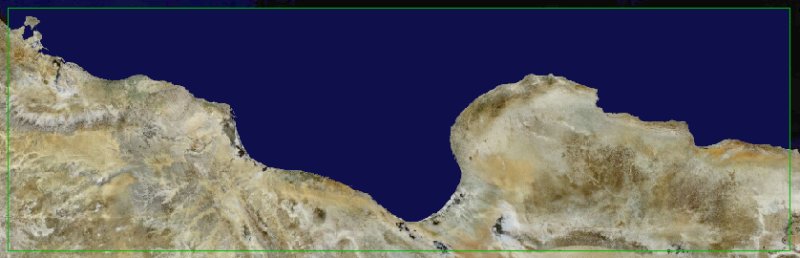
RAPIDEYE Satellite Images for Algeria, Tunisia and Libya by 3G 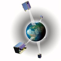
 RapidEye is the industry leader for the provision of 5m high-resolution satellite imagery and derived geo-information products. With a constellation of five identical Earth Observation satellites, RapidEye covers more than 4 million square kilometers of the Earth every day. Since the start of commercial operations in February 2009, RapidEye has collected over 3.3 billion square kilometers of imagery, equivalent to 22-times the Earth's land surface. RapidEye is the industry leader for the provision of 5m high-resolution satellite imagery and derived geo-information products. With a constellation of five identical Earth Observation satellites, RapidEye covers more than 4 million square kilometers of the Earth every day. Since the start of commercial operations in February 2009, RapidEye has collected over 3.3 billion square kilometers of imagery, equivalent to 22-times the Earth's land surface.
The 5 identical satellites provide unparalleled data collection security and safe planning for multi-year programs for RapidEye image users well into the year 2019, which is now the projected minimum lifespan of the constellation. Please contact us for specific information about the RapidEye capabilities for agricultural monitoring, topographic mapping and large-area visualization/simulation applications.
RapidEye is the most cost-efficient source for archive and new collection 5m images, starting at less than €1 per sq.km., with standard orthorectification provided at no extra cost to the customer. The current RapidEye price list can be downloaded here
- The RapidEye image specifications brochure (PDF) can be downloaded here
- Information on the constellation of the 5 identical RapidEye satellites (PDF) can be downloaded here
- How RapidEye satellite images can be used for the management and monitoring of agricultural areas (PDF) can be downloaded here
- The benefits of RapidEye images for Visualization & Simulation applications (PDF) can be accessed here
- To find out more about the new seamless and tone-balanced country mosaics offered by RapidEye, please download the PDF brochure here
|